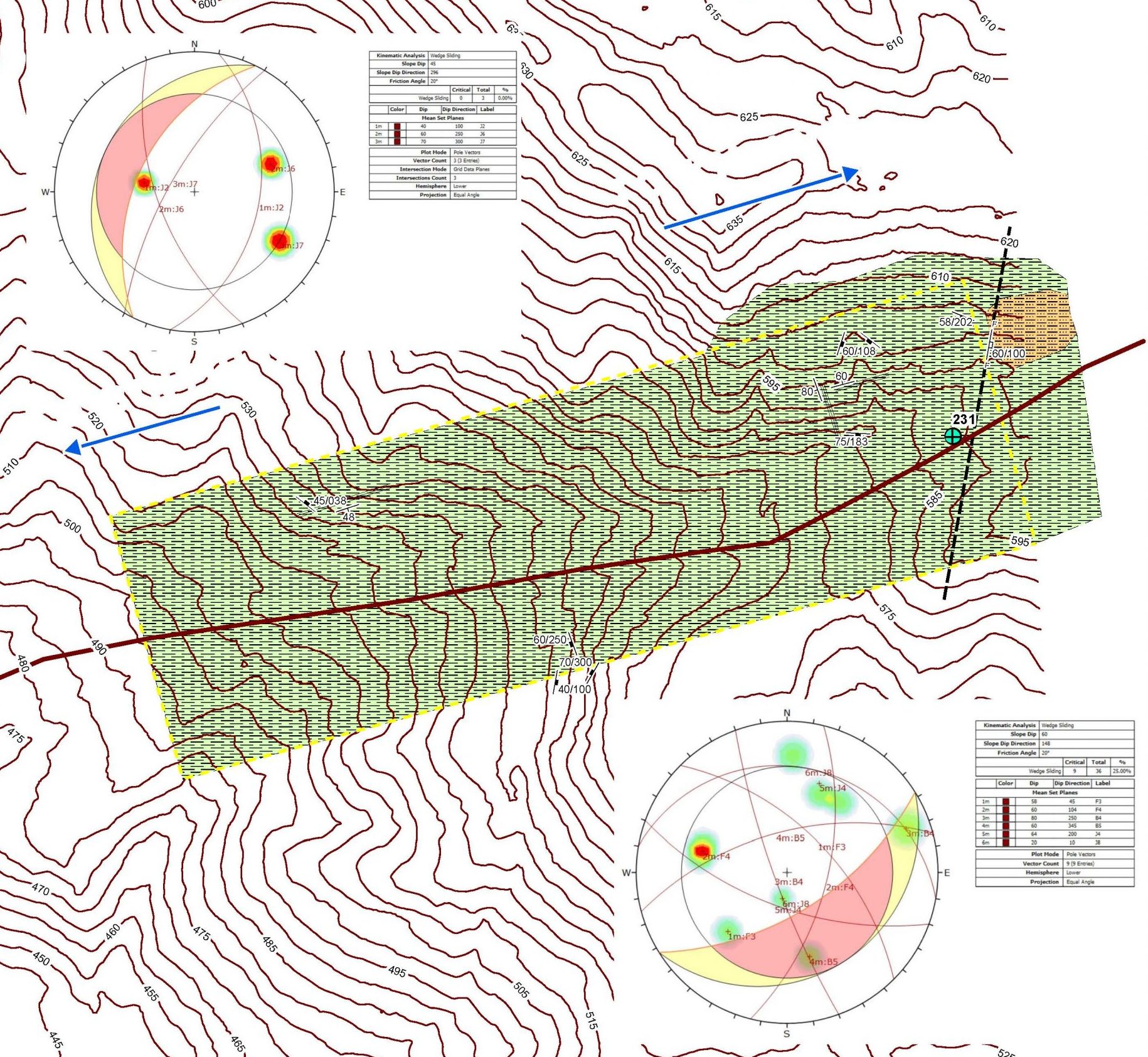
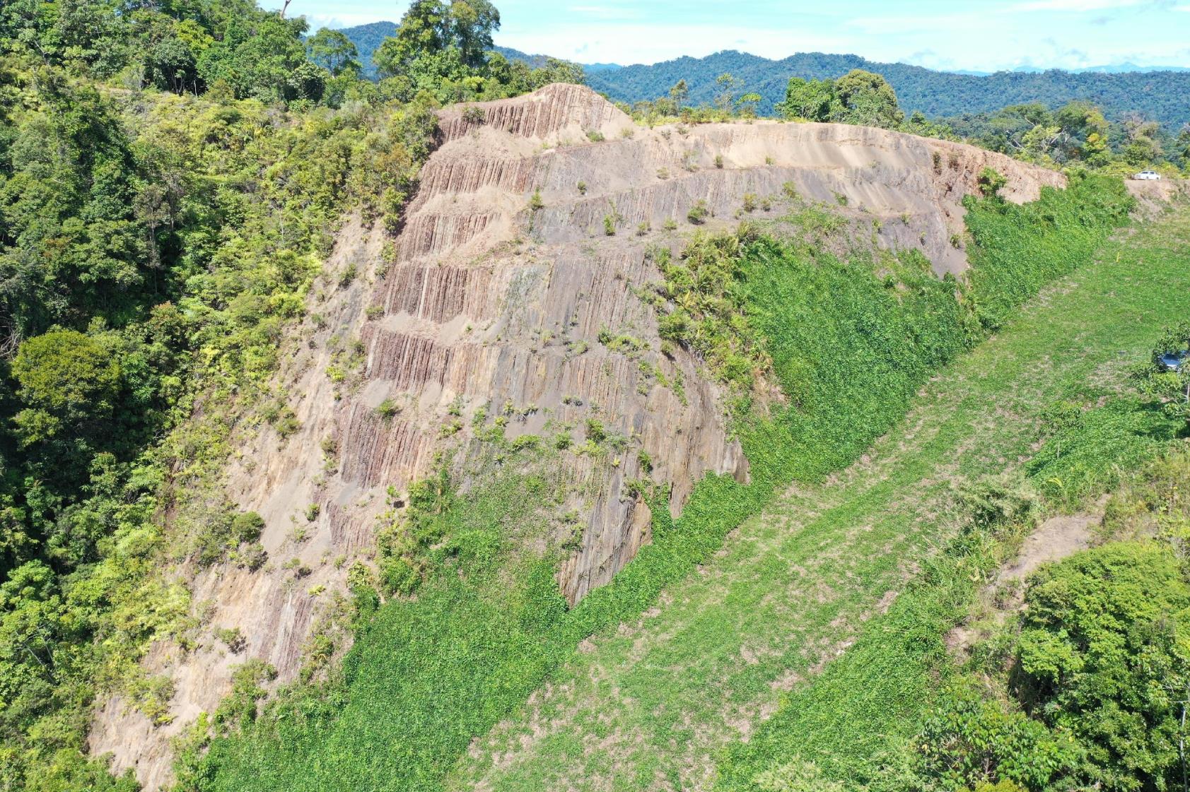
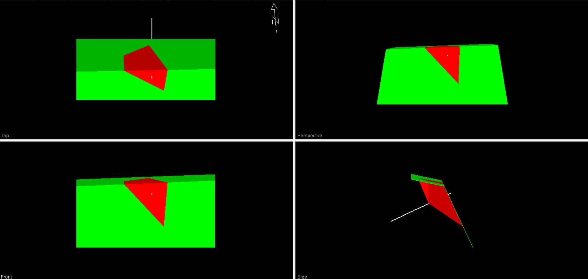
In the process of rock slope mapping and analysis, data is gathered regarding the geology of a particular site. This data collection can be done through manual mapping, drone survey, or LiDAR technology. The purpose of this data gathering is to assess the stability of the slopes and identify potential risks. Through slope stability analysis, factors such as the safety factor (FOS) are determined, along with the development of suitable mitigation plans, monitoring strategies, and maintenance programs.
Services
ROCK SLOPE MAPPING & ANALYSIS