Geographic Information System (GIS) is a powerful tool commonly used in geology. GIS enables geologists to create detailed maps by integrating various geological data, such as rock types, faults, folds, and stratigraphy. By digitizing and overlaying this information, GIS helps in the interpretation and analysis of geological features.
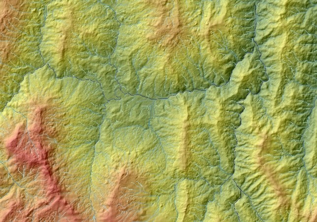
Furthermore, GIS facilitates terrain analysis by processing digital elevation models (DEMs) and other topographic data. Geologists can perform slope and aspect analysis, create watershed delineations, and identify landforms such as ridges, valleys, and drainage patterns. This information is valuable for understanding geomorphological processes and assessing natural hazards.