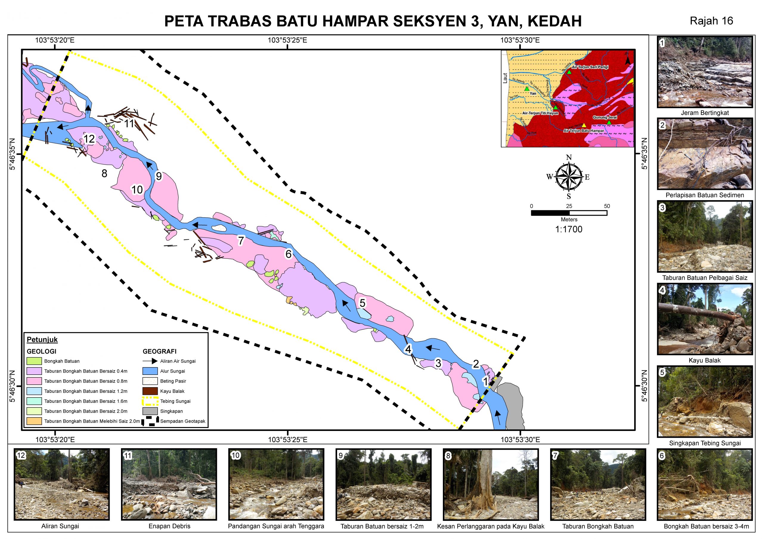
Geological Mapping is the process of mapping all geological elements found in a particular area. It includes mapping of rocks and unconsolidated sediments, as well as studying and identifying lithological relationships, stratigraphy, structures, rock unit ages, economic mineral potential, energy minerals, hydrogeology, engineering geology, geohazards, environmental geology, heritage geology, and so on.
Objectives of Geological Mapping;
• Conducting interpretation and analysis in order to identify regions affected by geohazards.
• Performing a survey of the landforms and creating a geomorphological map that displays all geological characteristics
• To determine the geodynamic features such as scarp, water seepage, distress, hanging block, ground settlement, tension crack, ephemeral drain etc